COLUMBUS
STREETCAR AND INTERURBAN MAP
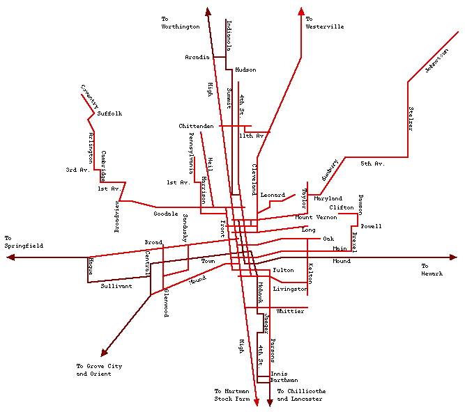
Map shows electric railway trackage in the Columbus area. Most local streetcar trackage is shown in red, and was broad gauge (5' 2 1/2"). In addition, several standard gauge interurban lines entered Columbus, and that trackage is shown in brown. Not indicated are several short segments of dual gauge trackage. The local streetcar company held the franchise to operate all local streetcar service, using a special group of standard gauge streetcars.
All streetcar lines were converted to trolleybus routes, except for West Mound, Pennsylvania, South 4th, Leonard, and Arlington.